Category Archives: Mountains

A Peek at the Alvord Desert

Alvord Desert
South East Oregon

The Alvord Desert is a 12 by 7 mile dry lake bed in southeastern Oregon. It lies in the rain shadows of the Steens Mountains and the Cascade range. This image is from a view point as I entered the desert from the south. While visiting Alvord, we witnessed air planes taking off, a wind sail vehicle catching a breeze, and a car racing across the desert. Next time I visit, I plan to catch a sunrise or sunset and maybe photograph the Milky Way. It is one of the darkest locations in the world.
Related Images:

Cloudy Day in the Badlands

Across from the Visitor’s Center
Banlands National Park

During my workshop in the Badlands, our group passed by the Visitor’s Center almost daily. This scene is just across the road from the center. Every day it had a different perspective. On my last day in the park, it was cloudy. The clouds and the filtered light accentuated the contrast between the hills and the sky as well as the trees. Infrared made the contrast even greater. I was thankful that I stayed an additional day in the park.

Related Images:

Ever Changing – What is Next?

Record of Changing Time
Badlands National Park

The exposed hills of the Badlands paint a picture of changing time. Each line on the hills represent a period of time where things were changing on our planet. It is hard to fathom that this area was once a giant sea bed that covered the central part of our continent. Layers upon layers of sediment illustrate the layers of time as our current central landmass was slowly building up. As the sea receded, the atmospheric winds and rains eroded the hills creating crevices and valleys that now host emerging plant life. What is next in the continuing evolution of our planet?

Related Images:

Hills and Ridges

Along Sage Ridge Road
Badlands National Park, SD

Colors, light, shadows, hills, ridges, and valleys … they are all here in the Badlands. The late afternoon sun pops out the colors, shapes, and textures from a rather grey-brown scene at midday. This image is not as sharp as I would like it to be, but it still captures the feeling of awe I had gazing over the vast landscape.

Related Images:

Blue Sky Day

Blue Sky Over Cherry Allee
Heatherwood Autumn

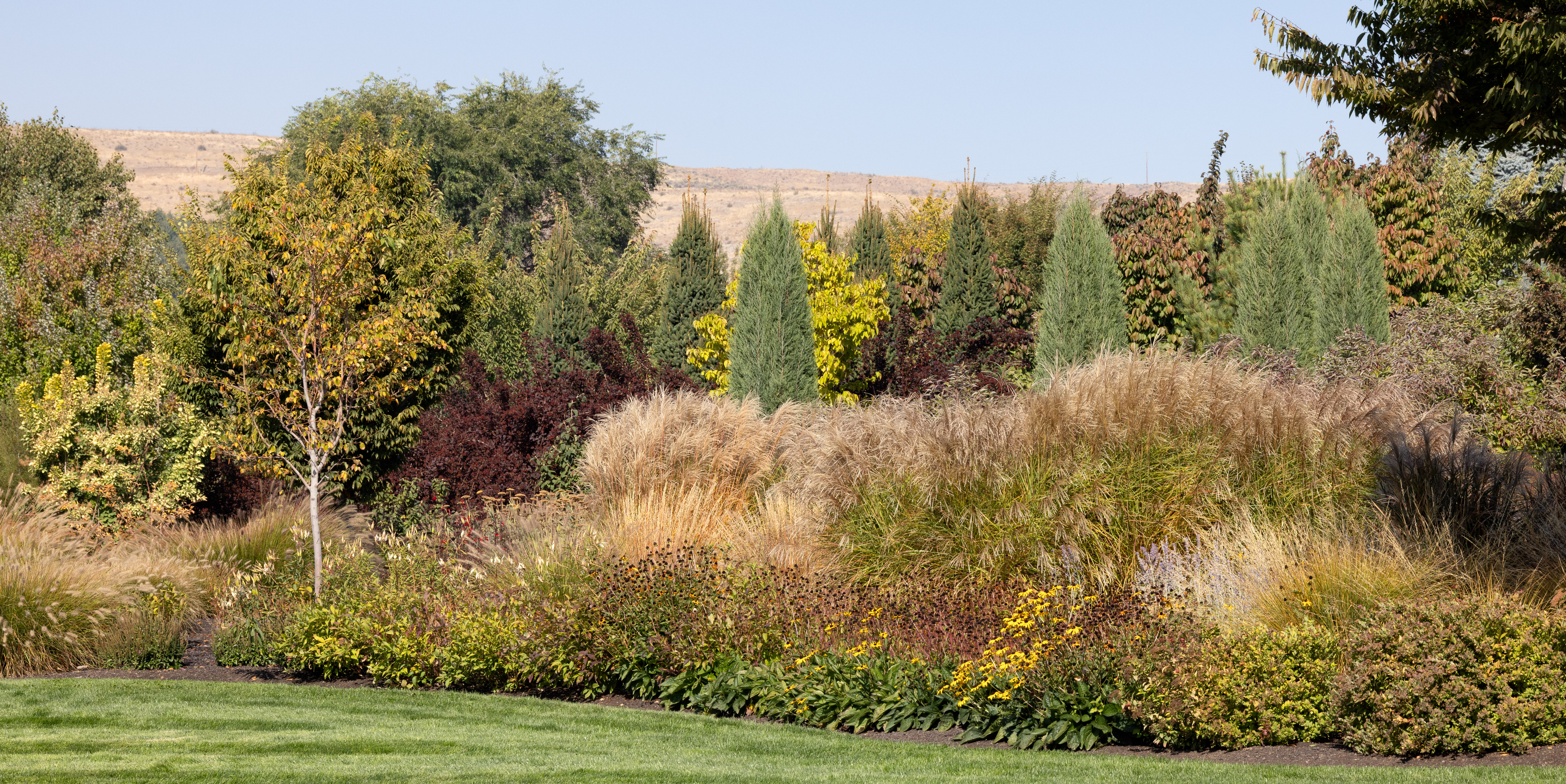
Some days are stunning. Heatherwood and the surrounding hills were absolutely beautiful on this late afternoon. Colors just popped out, especially the golden browns of the ornamental grasses and the panicle hydrangeas. The blue skies said summer, the garden colors said fall. I just strolled through the garden absorbing the warm afternoon sun and the colors of autumn. It was a great day!

Related Images:

Looking Northeast from the Neighbor’s

Selah Bluff and Lower Garden
Heatherwood Fall

A neighborhood garden should be designed to be enjoyed from the outside looking in as well as internally. As we designed Heatherwood, we wanted to provide a separation between our property and our neighbor’s. At the same time, we wanted to present a pleasing view from our neighbor’s back yard through our garden up to the hills rising above. In this section we kept the planting height down with ornamental grasses and mid-sized deciduous shrubs. For winter interest, the yellows, reds, and oranges of the Midwinter Fire, red twig, and yellow twig dogwoods mixed between the ornamental grasses will provide a textured and colorful winter foreground for the bluff above.

During our design process, we reviewed our concepts with our neighbor over a glass of wine or two. They were happy with what we envisioned and we were happy that they could enjoy it as much as we would.

Related Images:

Looking Under the Cottonwood Tree

View from the Visitors Center
Badlands National Park, South Dakota

Photographing in infrared is perfect for midday. All I need are a few clouds in the sky and some interesting foliage. This framed view is directly across the park road from the Visitors Center. It is great place to catch a little food and a photo or two.

Related Images:

A Little Rest

“Southeast Corner Rest Station”
Heatherwood Spring

We call the southeast area of our garden the “Conifer Corner.” We planted a row of conifers around the southeast corner of our garden to create a little privacy from our neighbors. Within the corner, we also have planted additional specimen conifer trees and shrubs. We added bright ground covers and perennials to give it a little pizzaz. We finished it off with a little rest area tucked into the corner. Many times after walking down to the bottom of our property, I take a little break before walking back up the hill. More times than not, I get sidetracked and wander into a little day dream. Sitting in the Adirondack settee, I look up and gaze into the scene below.

“Wide Angle View Looking Up the Hill”

You can see how easily I could fall into a day dream!

Related Images:

Which Peak Is the Highest?

“Mt. Whitney and Lone Pine Peak”
Alabama Hills, California

Boulders of the Alabama Hills frame Lone Pine Peak on the left and Mt. Whitney on the right. From this position, Lone Pine Peak (elev. 12,949 ft) looks significantly higher than Mt. Whitney (elev. 14,505 ft) in the background. It is just a matter of perspective.

Related Images:

Path Up to Mt. Whitney

“Mt. Whitney”
Eastern Sierras, California

The Mt. Whitney hike starts here in the Alabama Hills west of Lone Pine, CA. I reflect back to my younger days knowing that I could have made it to the top. Those years are long gone. Now I look up and just dream of what it would be like to be at the top looking down over the surrounding Sierras.

Related Images: