Tag Archives: geology

New Path to More Exploration

“On the Way to the Ridge”
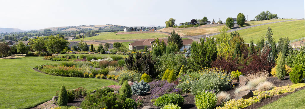
Selah Ridge, Washington

During my walk to the top of the cherry orchard I found a new way to get up to the top of Selah Ridge that overlooks the hillside where we live. There are so many places around our neighborhood to explore. The trek to the top of the ridge from here will be one that I plan to wander and explore.

Looking at this line of basalt rock, I ask myself how this remnant of a lava flow got way up here. Beneath this level of basalt lay strata of limestone-type sediments from an ancient sea bed. How did a sea bed get up here? Piecing the little that I know of the geologic history of the area, the following is what I think happened: First, this area at one time was under the Pacific Ocean. Then the volcanic Cascade Mountains were formed which separated Eastern Washington from the coastal plain. Later, the Eastern Washington, Eastern Oregon, Southern Idaho basalt flows covered what is now the Columbia Basin. Then the moving continental plates slowly forced up the Yakima Folds creating a line of ridges across south central Washington. We live at the base of one of these ridges.

Related Images:

A Beautiful Spring Day

Palouse River Canyon Below the Falls
Eastern Washington

Memorial Day was a beautiful Spring day! We woke up to a beautiful morning full of sunshine. It was time for a road trip! We decided to drive to the Palouse and visit Palouse Falls. Three hours later we were waiting in line to enter the Palouse Falls State Park. Many others had the same idea as we did. The drive and wait were worth it.

This image is taken from above the Palouse River just below the Palouse Falls. Recent rain created the green foliage on the plateau and canyon walls. Normally the scenery is pretty brown. The sky was covered by a patchwork of puffy white clouds. The scene was a a gift!

Related Images:

Yellowstone: Mammoth Hot Springs

Mammoth Hot Springs – Upper Basin

Yellowstone’s Mammoth Hot Springs area is also an area of unbelievable stark beauty.  How can life exist in such a harsh environment of boiling hot mineral springs.  I wonder how long these trees made it.

The day was hot around 90 degrees, we were tired and on our way back to photograph wildlife. We only took a few moments to walk around and take a couple of shots.  My creativity was at a low level, so I feel that I missed some wonderful opportunities to explore.  Well, next time …

Related Images:

Yellowstone: Grand Prismatic Spring – Lines 1

Grand Prismatic Spring -Mineral Flats

As the hot mineral water flows out of the spring, it creates a series of mineral flats.  This perspective  was a flat grey.  I decided to convert it  to black and white, add contrast, and apply a slight gradient across the image..

Related Images:

Yellowstone: Grand Prismatic Spring – Detail 1

Grand Prismatic Spring, Yellowstone National Park

A boardwalk runs along the edge of the spring.  The reflection of people walking along the walk caught my eye when the mist periodically lifted.  I did not have the foresight to be patient and take an image with a light mist to create the mystic feeling I felt.  Lesson learned;  Be ready to capture a “feeling” and not just a “picture”.


Related Images:

Yellowstone: Grand Prismatic Spring

Grand Prismatic Hot Spring

The Grand Prismatic Spring in Yellowstone National Park is the largest hot spring in the United States and the third largest in the world.  The immensity of the spring is very difficult to capture from the ground level.  I had my 24-105mm lens and only could capture a portion of the spring.  I could not change to my 14mm wide angle because of the extreme harsh mist generated by the hot spring.  On my next visit I will make two trips to photograph from the ground level.  The first will be with my wide aperture lens to try to capture as much of the overall grandness of the spring.  The second will be with my mid-range zoom to capture the details. To get a full photo of the spring, one needs to hike up the trail on the hill above the spring.  The trail is currently (June 2017) in construction and not accessible..

I found the details of the water and mud beds below fascinating.  Lines, colors, and reflections intrigued me.  I will display images of some of those images in future posts.

Related Images:

Sentinel Gap on Columbia River

Sentinel Gap Looking South from Frenchman’s Spring Coulee

This image was taken from the bottom of Frenchman’s Spring Coulee near where it enters the Columbia River.  Sentinel Gap was cut across the Saddle Mountains by the Columbia River and the Ice Age Floods.  During the floods, the Columbia River was at a level near the top of the eastern slope of the Gap.  On the north side of the Gap, the Vantage Bridge and Wanapum Dam are faintly visible.  Through the Gap, Umatilla and Rattlesnake Ridges are visible.  And of course, the clouds make the image.


Related Images:

Frenchman’s Spring Coulee

Frenchman’s Spring Coulee – near Vantage, WA

This image is taken from the top of the Frenchman’s Spring Coulee looking down toward the Columbia River.  The mountains in the far background are the Cascade foothills. This coulee was created during the Ice Age Missoula Floods.  It is the farthest south water path from the Quincy Basin to the Columbia River.  The flood waters in the Quincy Basin were split by the Frenchman hills, just south of this coulee.  The water flowed east into the Drumheller Channels toward Othello and west into the Columbia River via several coulees including Frenchman Springs.

The wind was howling, so I did not feel like getting too close to the edge.  I bet this will make a good sunset or sunrise photo.  I will be back.


Related Images: